
Metro Vancouver · Wet-weather walking
Rain-Friendly Vancouver Walks by Transit
A wet forecast does not have to cancel every walk. Choose a simple surface, a short exit and a transit plan you can reverse—then let wind, water and visibility make the final call.
- Region
- Vancouver, Burnaby and West Vancouver, British Columbia
- Best for
- Families, newcomers and casual walkers planning without a car
- Season
- Year-round; daylight, wind, rainfall and local notices decide the day
- Time
- A short out-and-back or flexible partial loop
By Horizon Outdoor Editorial TeamPublished 2026-08-29Updated 2026-08-31
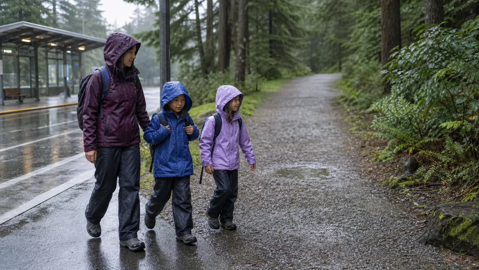
Quick facts
- Route shape
- Short out-and-back with an obvious exit
- Transit check
- Trip Planner plus current service alerts
- Ground check
- No standing water, fast flow or closed section
- Turn back for
- Rising wind, poor visibility or fading daylight
Treat “rain-friendly” as a planning choice, not a safety promise
The useful question is not whether a walk is safe in rain. It is whether today’s rainfall, wind, visibility, ground conditions and daylight leave a comfortable margin on a particular route. A paved or broad path can simplify navigation, but it cannot prevent pooling, falling branches, wave overtopping, a swollen creek or an unexpected closure.
Check Environment and Climate Change Canada for the Vancouver-area forecast and active alerts shortly before leaving. Its Weather Impact Guides connect significant rain with water pooling and flooding, damaging wind with falling debris, poor visibility with difficult navigation, and coastal flooding with waves or water reaching shoreline routes. Those are decision signals, not background details.
Cancel or replace the walk when an alert affecting the place and time describes hazardous wind, flooding, coastal impacts or poor visibility. Also stop at the trailhead if water covers the intended surface, a creek is fast or outside its channel, trees or large branches are moving sharply, posted signs close the route, or the return would run into darkness.
- Green light: manageable forecast, open route, clear sightlines and a daylight return
- Downgrade: choose a shorter paved section when surfaces or comfort are uncertain
- No-go: relevant hazardous-weather alert, closure, overtopping water or unstable trees
Build the return trip before choosing how far to walk
Enter the actual park entrance or waterfront access point in TransLink’s Trip Planner, not only the park name. Review the suggested walking connection, transfers and return options for the day you will travel. Do not save a sample itinerary as a permanent timetable: service patterns, stop locations and travel conditions can change.
Then open TransLink service alerts separately. TransLink notes that planned disruptions, construction reroutes and special-event changes are not always included in Trip Planner, so the two checks serve different purposes. Repeat them before departure and again before starting the walk if the weather or network is unsettled.
Choose a route with at least two simple exit choices and turn around while the first return option still feels easy. In darker months, set the turnaround from the expected daylight at the destination, not from dinner time. A headlamp or phone light belongs in the bag, but it is not a reason to extend an unfamiliar wet route after dark.
- Pin the exact entrance and intended finish before leaving home
- Check Trip Planner and service alerts as separate live sources
- Keep enough time to reach a known stop before daylight and patience run out
Use Vancouver’s waterfront in short, reversible pieces
The False Creek portion of Vancouver’s Seawall and Seaside Greenway works best here as a short point-to-point or out-and-back between urban access points. The City describes a clearly marked waterfront system for walking and cycling, but sharing space still requires attention. Keep the outing compact when rain reduces sightlines or water gathers across the path.
For Stanley Park, choose an east-side out-and-back from the Coal Harbour side rather than committing to the full nine-kilometre circuit. The City specifically identifies heavy rain and windstorms as causes of rock and debris-slide risk on sections between Prospect Point and Third Beach, where winter maintenance closures and signed detours can occur. Never pass a barrier to preserve a loop.
Both waterfront choices are exposed enough for wind direction and waves to change the feel of an otherwise easy path. Turn away from the shoreline when spray or water crosses the walking surface, gusts affect balance, debris begins to fall, or visibility no longer gives walkers and cyclists enough time to see one another.
- False Creek Seawall: flexible urban segment with multiple possible endpoints
- Stanley Park east side: partial out-and-back, not an obligation to circle the park
Keep forest and lakeside walks conservative after sustained rain
At Pacific Spirit Regional Park, use the official map to select a straightforward interior trail combination and remain on marked trails. The map distinguishes hiking and shared trails and identifies creeks, cliffs and no-access areas. A broad forest corridor can feel calm in light rain, but wet roots, mud, low forest light and wind-loosened branches still require an early turnaround.
At Deer Lake Park, begin near the cultural precinct and choose only as much lakeside path as conditions support. The City lists crushed gravel, hard-packed dirt and wooden boardwalk on the main route, and warns that some paths may be steep and that roots create trip hazards. This is a reason to prefer a short out-and-back, not to promise the full loop.
For either place, check the park authority’s current notices and assess every creek crossing, boardwalk and low spot in front of you. Do not step into pooled water to test its depth or use an unofficial detour around mud. Turn back for flowing water over the route, a rising creek, deepening puddles, unstable footing, falling debris or a posted closure.
- Pacific Spirit: mapped interior trails only; avoid improvised canyon or beach descents
- Deer Lake: choose a surface and distance that still work when wet
Choose Ambleside when the coast is calm enough to stay comfortable
Ambleside Park offers a waterfront footpath and connects with the Spirit Trail, and the District of West Vancouver directs visitors to public transit and TransLink’s planner. Treat those features as route flexibility rather than a guarantee. Plan a short walk near a known entrance and keep the return simple if the rain becomes colder or heavier.
The open shore gives you fewer branches overhead than a forest route, yet greater exposure to wind, spray and changing coastal water. Stay on the designated pedestrian path and follow posted signs where uses differ. A quieter-looking beach is not an invitation to walk close to waves during rough conditions.
Choose another day when a relevant coastal flooding or damaging-wind alert is active, or when water or spray is overtopping the route. Turn back if gusts affect balance, loose objects are moving, the opposite shoreline fades enough to reduce orientation, or the walk to the transit stop would finish in poor light.
- Best shape: a short waterfront out-and-back from a known access point
- Main exposure: wind, spray, coastal water and an open return
Carry a small margin, then make the decision again outside
Wear footwear with dependable wet-surface grip and carry a waterproof shell, a light warm layer and dry socks protected inside the bag. Add water, a snack, needed medication, a small light, phone power and the fare or payment method required for the return. Bright or reflective details help other path users notice you in grey conditions.
Before leaving the transit stop, pause for a field check: can you see the intended route, is the surface draining, are nearby creeks within their banks, and are branches stable? If reality is worse than the forecast, shorten or abandon the walk. Forecast icons never overrule water, barriers or movement you can see.
For a family, plan around the least comfortable walker and name the stop conditions aloud before starting. Cold hands, soaked layers, repeated slips, fear, poor visibility or a delayed return are enough reasons to end the outing. The most useful rain walk is one that leaves everyone willing to try another carefully chosen day.
- Keep the rain shell, light and return fare reachable without unpacking
- Recheck surface, water, trees, visibility and daylight at the entrance
- Use the first agreed stop condition; do not negotiate with a deteriorating route
Common planning mistakes
- Treating “easy” or “paved” as a promise that rain cannot make the route hazardous
- Checking Trip Planner but skipping the separate service-alert page
- Committing to a full loop before seeing water levels, footing and visibility
- Entering pooled or moving water to avoid turning around
- Starting late because a familiar city park seems simple after dark
Printable companion
Download the student weekend checklist
A compact weekend list for clothing, toiletries, documents, chargers, shared car basics and the reset before returning home.
Download the free PDFQuestions travellers ask
Are these walks safe in every kind of rain?
No. They are options that can be planned in short, reversible sections. Active alerts, closures, damaging wind, poor visibility, overtopping water, swollen creeks, unstable trees or fading daylight can make any of them a no-go.
Which option is simplest for a first wet-weather walk?
Start with a short urban waterfront segment that has a clear transit return and several obvious exits. Check wind, coastal conditions and surface drainage first, and turn back before comfort or visibility deteriorates.
Can I rely on the transit route I used last time?
Do not assume it is unchanged. Run the exact origin, entrance and travel time through TransLink Trip Planner, then review service alerts because some disruptions and reroutes may not appear in the planner.
Does this guide confirm wheelchair or stroller accessibility?
No. Surfaces, slopes, construction, elevators, connections and weather impacts can change. Check the current park and TransLink accessibility information for the specific entrance and journey before deciding whether it fits your needs.
Sources and currency
Conditions change. Confirm dynamic details again before departure; each source shows its own last-checked date.
- TransLink: Trip Planner, real-time information and transit-alert limitations (2026-08-29)
- Environment and Climate Change Canada: Local forecasts and weather alerts for Canada (2026-08-29)
- Environment and Climate Change Canada: Weather Impact Guides for rain, visibility, wind and coastal flooding (2026-08-29)
- City of Vancouver: Vancouver Seawall route and Stanley Park slope-maintenance information (2026-08-29)
- City of Vancouver: False Creek Seawall and Seaside Greenway overview (2026-08-29)
- Metro Vancouver: Pacific Spirit Regional Park official trail map (2026-08-29)
- Metro Vancouver: Regional park alerts, restrictions and closures (2026-08-29)
- City of Burnaby: Deer Lake Park trails, surfaces, hazards, hours and transit planning (2026-08-29)
- District of West Vancouver: Ambleside Park paths, public transit and posted-use guidance (2026-08-29)
Continue planning
Related field guides
Vancouver · Beginner-friendly trails
Easy Hikes Near Vancouver for Beginners
You do not need to start with a summit. Vancouver’s easiest outdoor days begin with a short trail, a realistic weather check and enough margin to turn around while everyone still feels good.
Open the guide
British Columbia · Family outdoor living
Your First Outdoor Summer in BC
A BC summer can mean a damp coast, a hot interior valley or lingering snow at higher elevations. Start close, keep the plan flexible and let the family finish wanting another day outside.
Open the guide
British Columbia · Highway 99
Sea to Sky Highway Road Trip Guide
Ocean, granite, forest and mountain towns arrive quickly on this compact BC route. Choose a few strong stops, check conditions before departure and protect the return drive from becoming rushed.
Open the guide