
Ottawa–Gatineau · Outdoor living
Easy Outdoor Days Around Ottawa–Gatineau
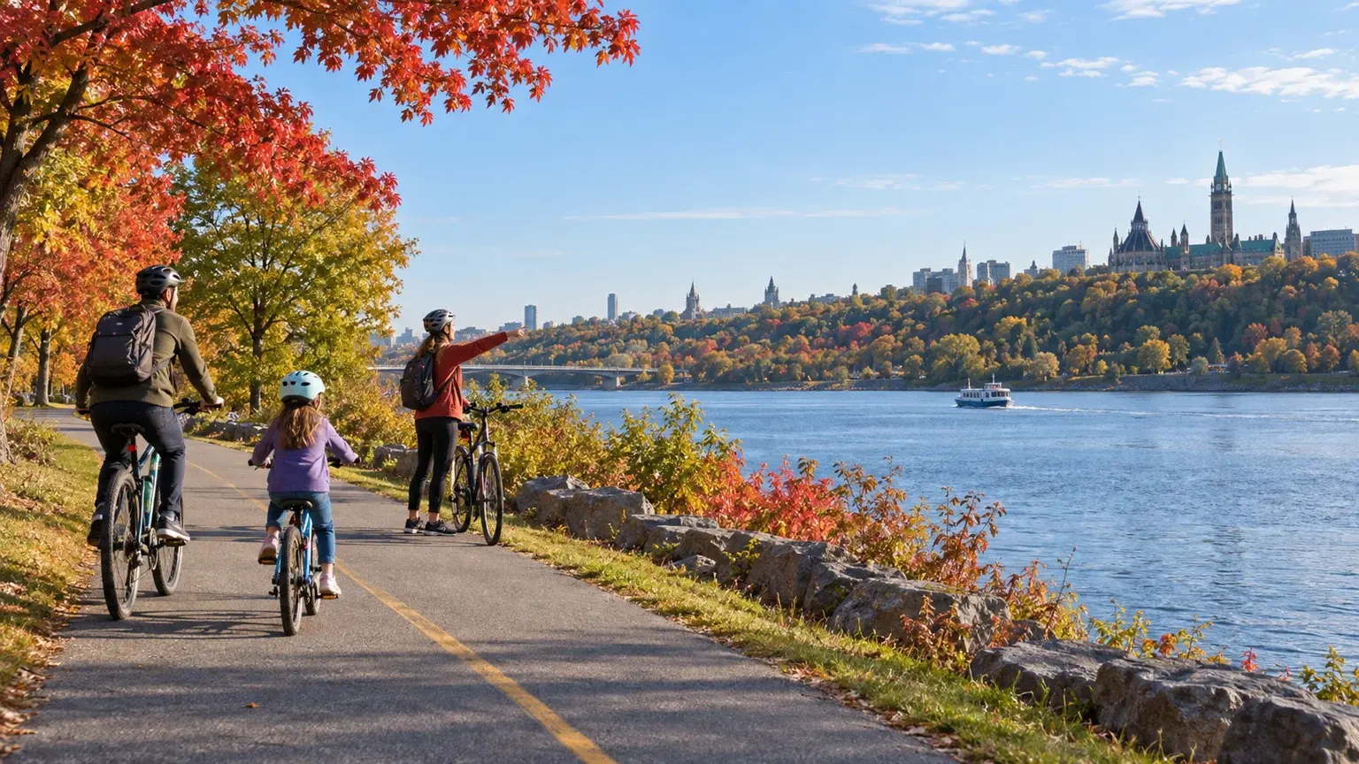
The National Capital Region offers several layers of outdoor life within one connected area. Begin with a river or urban pathway, move outward to a Greenbelt trail, and treat Gatineau Park as a separate access decision rather than an automatic next stop.
- Region
- Ottawa, Ontario, and Gatineau, Quebec
- Best for
- Families, newcomers and visitors looking for an approachable outdoor day
- Season
- Year-round; route use, vehicle access and trail networks change by season
- Time
- Two hours to one full day
By Horizon Outdoor Editorial TeamPublished 2026-09-10
Quick facts
- Lowest-friction day
- A river or Capital Pathway out-and-back
- Nature next step
- One Greenbelt sector and its exact starting point
- Park decision
- Check Gatineau trail map and seasonal access together
- Regional habit
- Save the return route on the same side of the river
Choose one layer of the region for the day
Ottawa–Gatineau can support a short pathway outing, a natural Greenbelt walk or a fuller Gatineau Park day. These choices may appear close on a map, but they ask for different transport, footwear, time and seasonal checks. Decide which layer fits the day before collecting individual attractions.
A river pathway is useful when the group wants easy navigation and a flexible turnaround. A Greenbelt sector adds natural trails and distinct starting points while remaining close to Ottawa. Gatineau Park adds a much larger protected landscape, interconnected routes and access rules that deserve their own plan.
- Pathway: flexible distance and simple return
- Greenbelt: one sector, trail and starting point
- Gatineau Park: trail map, access mode and season as one decision
Use the Greenbelt by sector, not as one destination
The Greenbelt forms a broad horseshoe around Ottawa, and its trails begin from different parking areas and transit connections. Choose a sector such as Mer Bleue, Stony Swamp or Green’s Creek for the landscape or activity it offers, then save the exact starting point. Typing only “Greenbelt” into navigation does not complete the access plan.
The National Capital Commission publishes trail lengths, surfaces, starting points and dog policies. Spring thaw, wet ground, closures and seasonal rules can change the appropriate route, so read the current advisory and stay on the established trail even when the edge looks drier.
- Name the sector and starting point
- Match surface and length to the group
- Check current advisories and dog rules
Plan Gatineau Park access before choosing the viewpoint
Gatineau Park has multiple activity hubs and entry points. Some parkway access changes by season and schedule, while shuttle, bicycle, walking and private-vehicle options do not serve every place in the same way. Start with the official getting-there page and trail map, then select a route that works with the actual access method.
Download the correct seasonal trail map. Summer and winter networks can support different uses, and a familiar route name does not mean the same surface or activity is available all year. On busy days, an alternate hub or a Greenbelt plan may protect the day better than waiting for one popular parking area.
- Choose the access mode and activity hub together
- Download the map for the current season
- Keep an alternate hub or Greenbelt outing ready
Plan the complete return across a two-province region
Crossing between Ontario and Quebec can be a small part of the day or the source of unnecessary friction. If the route begins on one side of the river and finishes on the other, confirm the bridge, transit, cycling or pickup plan before departure. Do not assume a pleasant one-way path will produce an easy family return.
Check the forecast for the actual destination and the hours outside. River wind, summer heat, rain, snow and limited daylight can affect a short route. Carry water, food, a useful layer, navigation and medication, and set the turnaround while everyone still has enough energy to get home.
- Save the return route before starting
- Check the forecast for the chosen side and activity
- Protect enough time and energy for the final kilometres
Keep the region connected by staying on official routes
Official trails reduce habitat fragmentation and make seasonal activity management possible. Stay on them, respect dog and bicycle policies, avoid widening muddy edges and leave natural material in place. A trail close to Parliament or a suburban road can still pass through sensitive habitat.
Finish by deciding which layer the group wants to repeat. Outdoor confidence in Ottawa–Gatineau comes from understanding the network, not from crossing the greatest possible distance in one day.
- Use the official seasonal route
- Follow activity and dog policies for that trail
- Repeat a useful layer before adding complexity
Common planning mistakes
- Treating the Greenbelt as one navigation destination
- Choosing a Gatineau viewpoint before checking parkway or shuttle access
- Using a summer map for a winter activity
- Planning a one-way river route without the return
- Leaving a popular full lot as the only acceptable plan
Printable companion
Download the family road trip checklist
A printable family list for car comfort, weather changes, food stops, simple outdoor days and backup plans.
Download the free PDFQuestions travellers ask
What is the easiest first outdoor day in Ottawa–Gatineau?
Choose a river or Capital Pathway section with a clear out-and-back route. It gives the group control over distance and makes the return easy to understand.
Is the Greenbelt one continuous trail?
No. It is a large protected area with sectors, natural trails and multi-use pathways that have different starting points, surfaces and policies. Plan for one specific sector.
Can we drive everywhere in Gatineau Park?
No. Access to parkways and destinations varies by season and schedule. Check the official getting-there information, shuttle details and current trail map for the chosen activity.
Do we need separate plans for summer and winter?
Yes. Trail networks, permitted uses, parkway access, surfaces and equipment can change. Use the current seasonal map and destination information each time.
Sources and currency
Conditions change. Confirm dynamic details again before departure; each source shows its own last-checked date.
- National Capital Commission: Hiking and walking in the Greenbelt (2026-09-10)
- National Capital Commission: Greenbelt hours, directions, maps and planning tools (2026-09-10)
- National Capital Commission: Getting to Gatineau Park (2026-09-10)
- National Capital Commission: Gatineau Park trail maps (2026-09-10)
- National Capital Commission: Hiking and walking in Gatineau Park (2026-09-10)
- Environment and Climate Change Canada: Canadian weather forecasts and alerts (2026-09-10)
- AdventureSmart: Trip planning, training and essentials (2026-09-10)
Continue planning
Related field guides
Canada · First national park trip
Canada National Parks First-Time Guide
A first national park visit works best when the logistics are visible before the scenery takes over: entry, reservations, roads, weather, wildlife and a day plan that can shrink.
Open the guide
Printable planning guide
Canada Road Trip Packing Checklist
Start with the essentials that protect the trip, then remove anything your route, season and travelling party do not need.
Open the guide
Canada · First-trip shortlist
Canadian Road Trips for First Visits
Canada is too large for a single “best” road trip. Start with the landscape you want, the driving rhythm you enjoy and the logistics you are ready to manage.
Open the guide